
TOYOTA's "Toreta Michi Map" Utilizes G-BOOK
TOYOTA | Toyota
Releases "Roads Open Map" Utilizing G-BOOK
To support travel around areas affected by the Great East Japan Earthquake, Toyota is releasing traffic実績 information (probe information) collected from G-BOOK-equipped vehicles. They state it can be used as a reference when checking passable roads.
By Matsuo Dai
Information Updated Daily at 10 AM
Information can be viewed on Google Maps and Google Earth. From PCs and smartphones, access the Google Maps display (http://maps.google.co.jp/maps?q=http://g-book.com/disasterMap/ALL/Tohoku-Jishin_更新日.kmz). Traffic実績 information around the affected areas will be displayed, and you can zoom in/out and pan using on-screen controls or mouse operations.
Google Earth can only be viewed on PCs. After installing Google Earth, download from the KMZ file (http://g-book.com/pc/spot/Tohoku-Jishin.asp). Double-clicking the downloaded KMZ file will automatically launch Google Earth and display traffic実績 information around the affected areas. The filename for this KMZ file is "Tohoku-Jishin_更新日.kmz", and it needs to be downloaded each time it is updated.
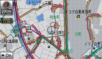
The detailed traffic実績 information is color-coded: blue for 10 or more vehicles traveling in both directions, green for 10 or more vehicles traveling in one direction, and yellow for 1 to fewer than 10 vehicles.
Information is updated around 10 AM daily, with data from the previous 24 hours uploaded. Of course, even roads with recorded traffic実績 may become impassable due to subsequent changes in conditions or traffic regulations. Therefore, it is advisable to confirm this information in conjunction with data provided by road administrators such as the police, Ministry of Land, Infrastructure, Transport and Tourism, and national highway offices.
For detailed information, please refer tohttp://g-book.com/pc/spot/Tohoku-Jishin.asp.